Via Roma through the landscapes and heritage of Calci
location:
Calci
ITALY
client:
City of Calci
year:
2019
program:
public space - landscape
status:
competition - 3rd prize
Calci
ITALY
client:
City of Calci
year:
2019
program:
public space - landscape
status:
competition - 3rd prize
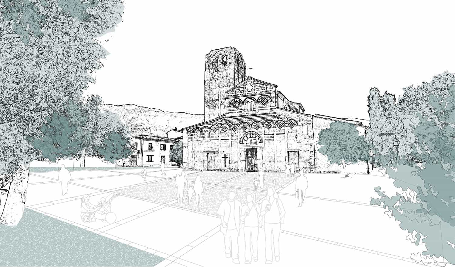
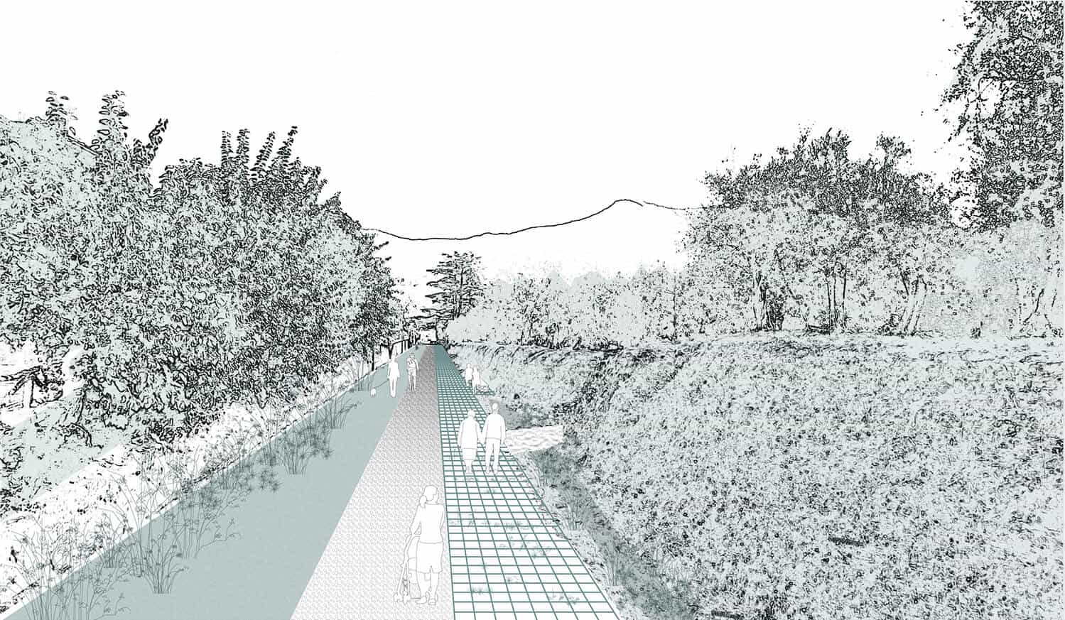
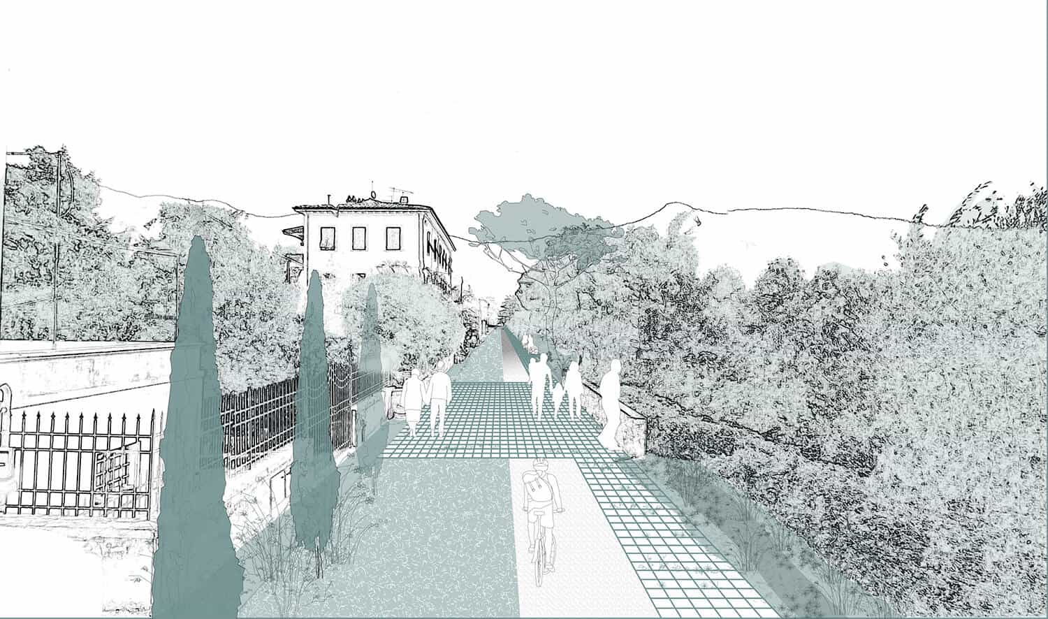
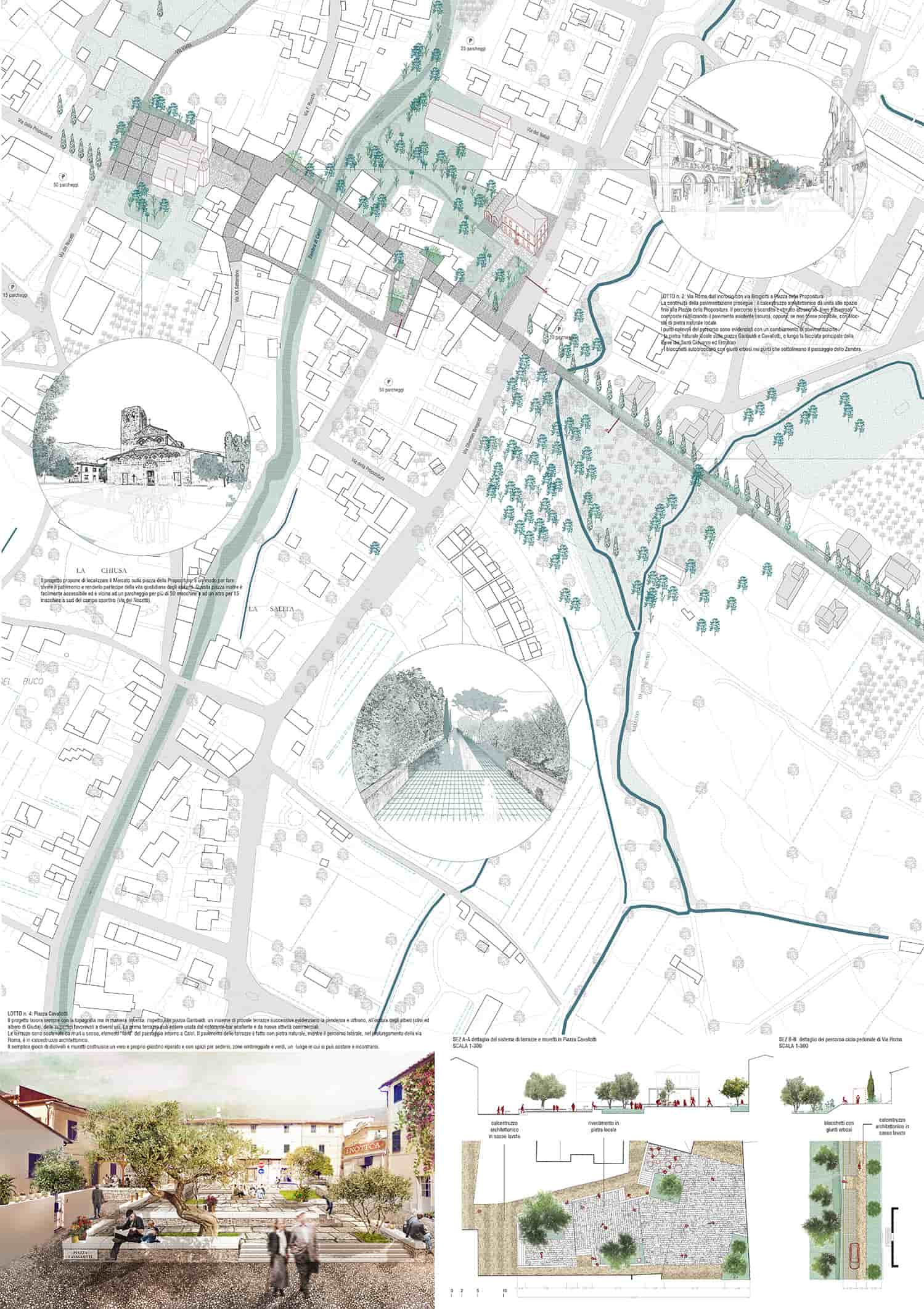
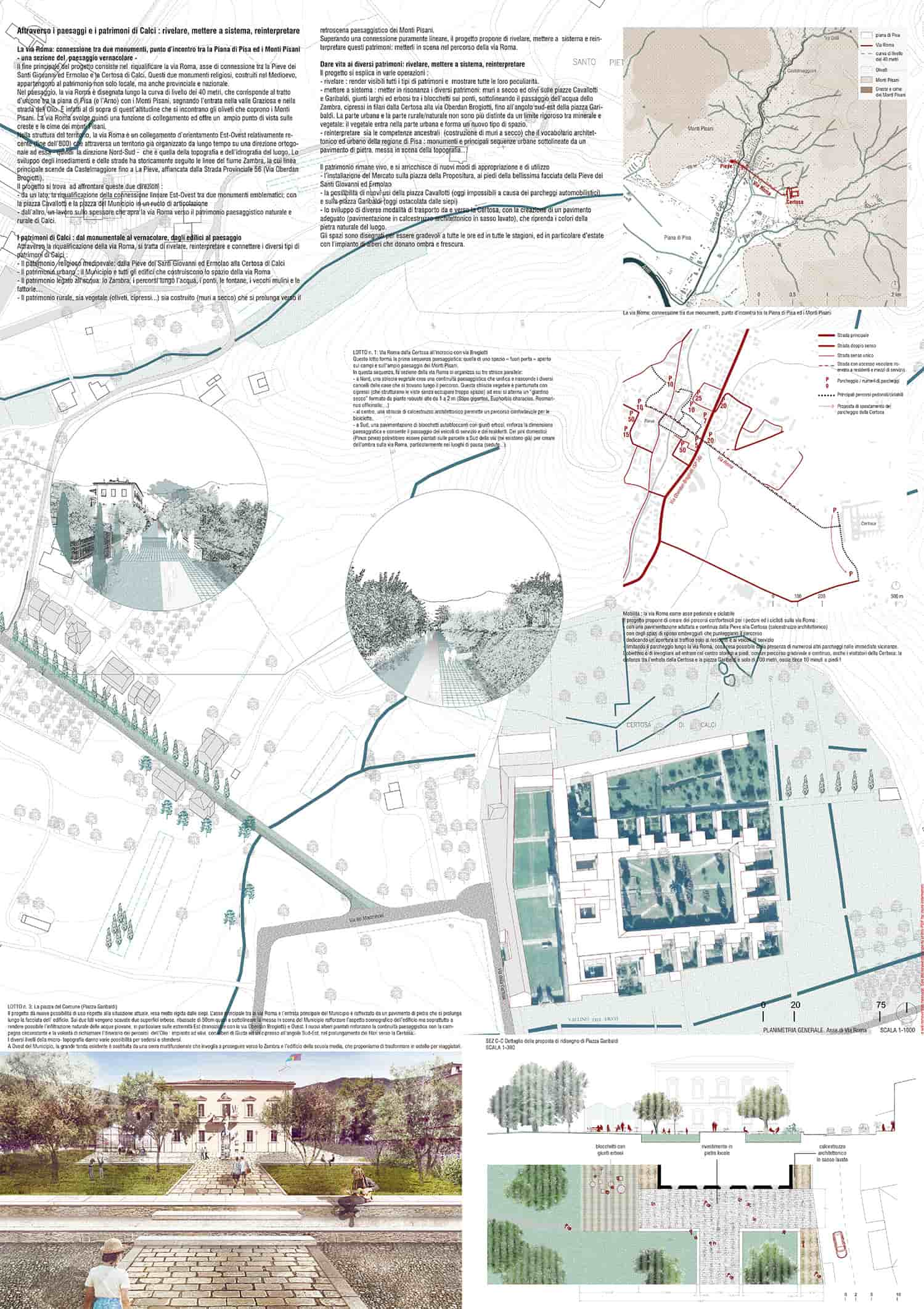
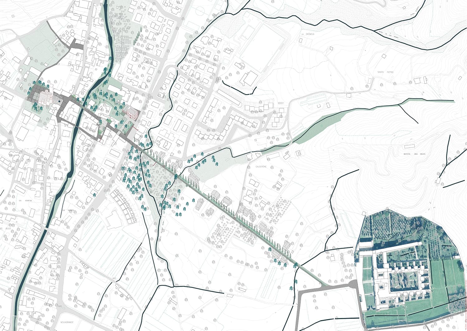
Via Roma is the connection between two monuments and the meeting point between the Piana di Pisa and the Monti Pisani - a section of the vernacular landscape.
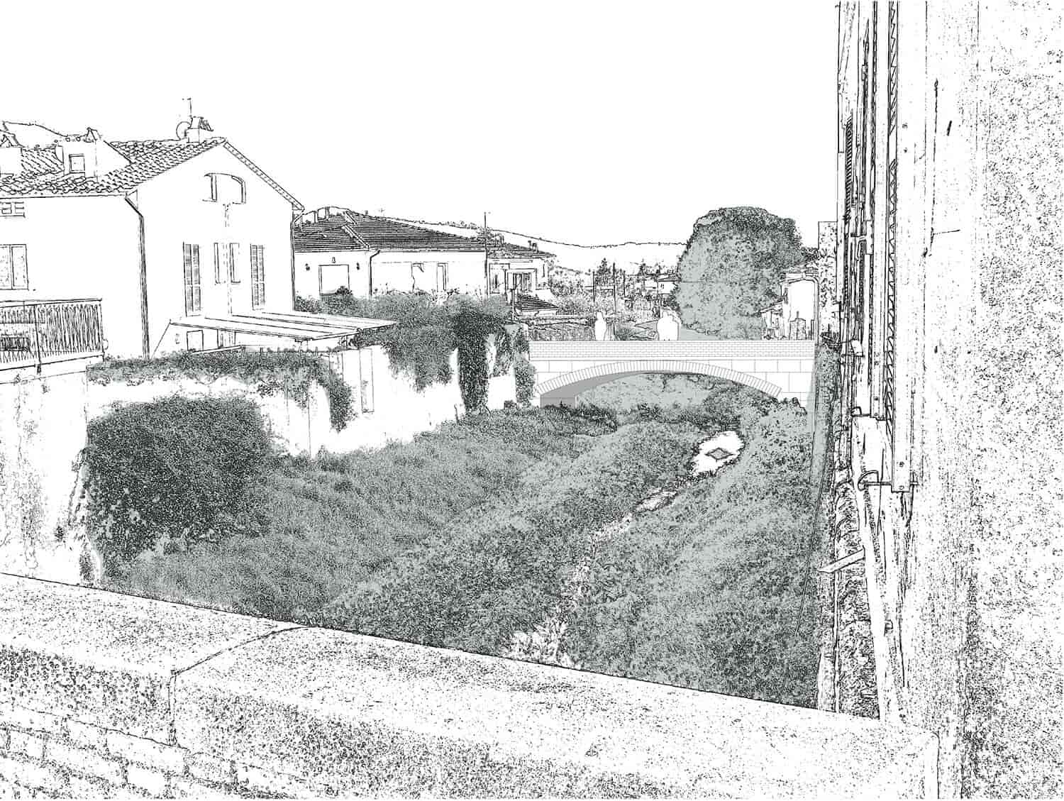
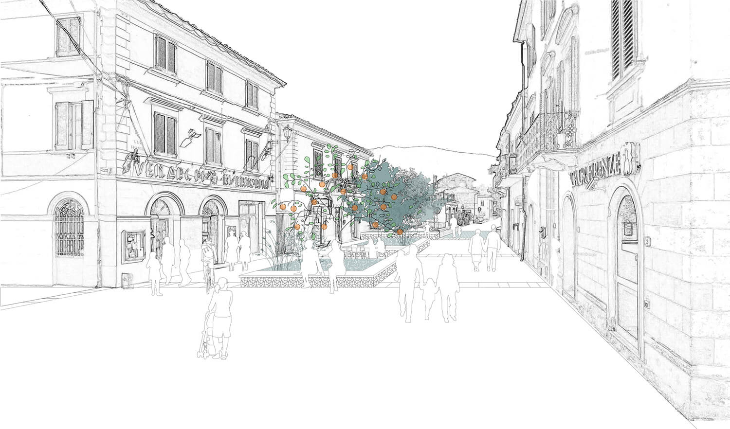
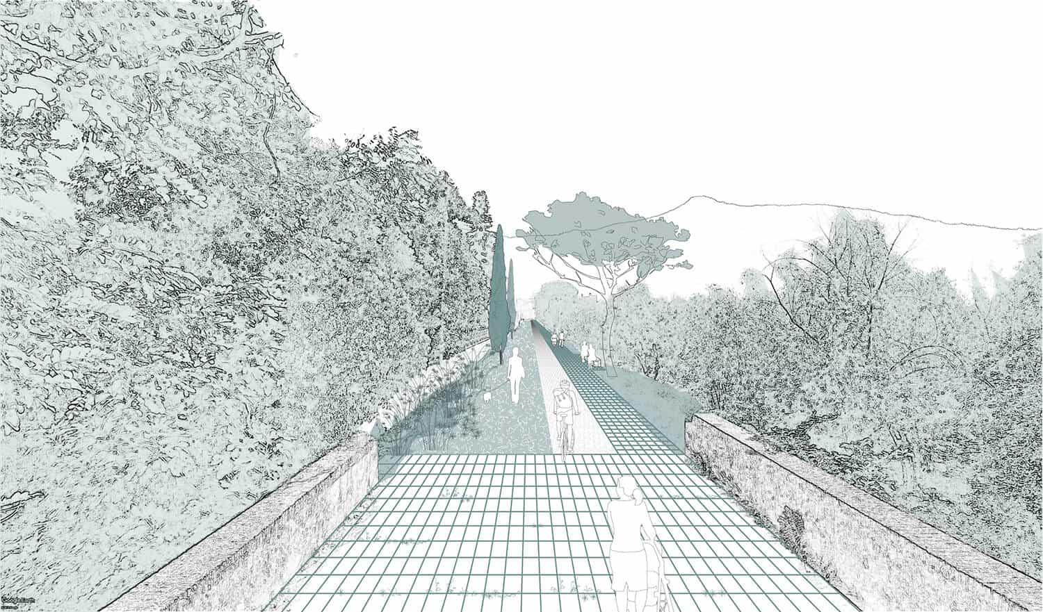
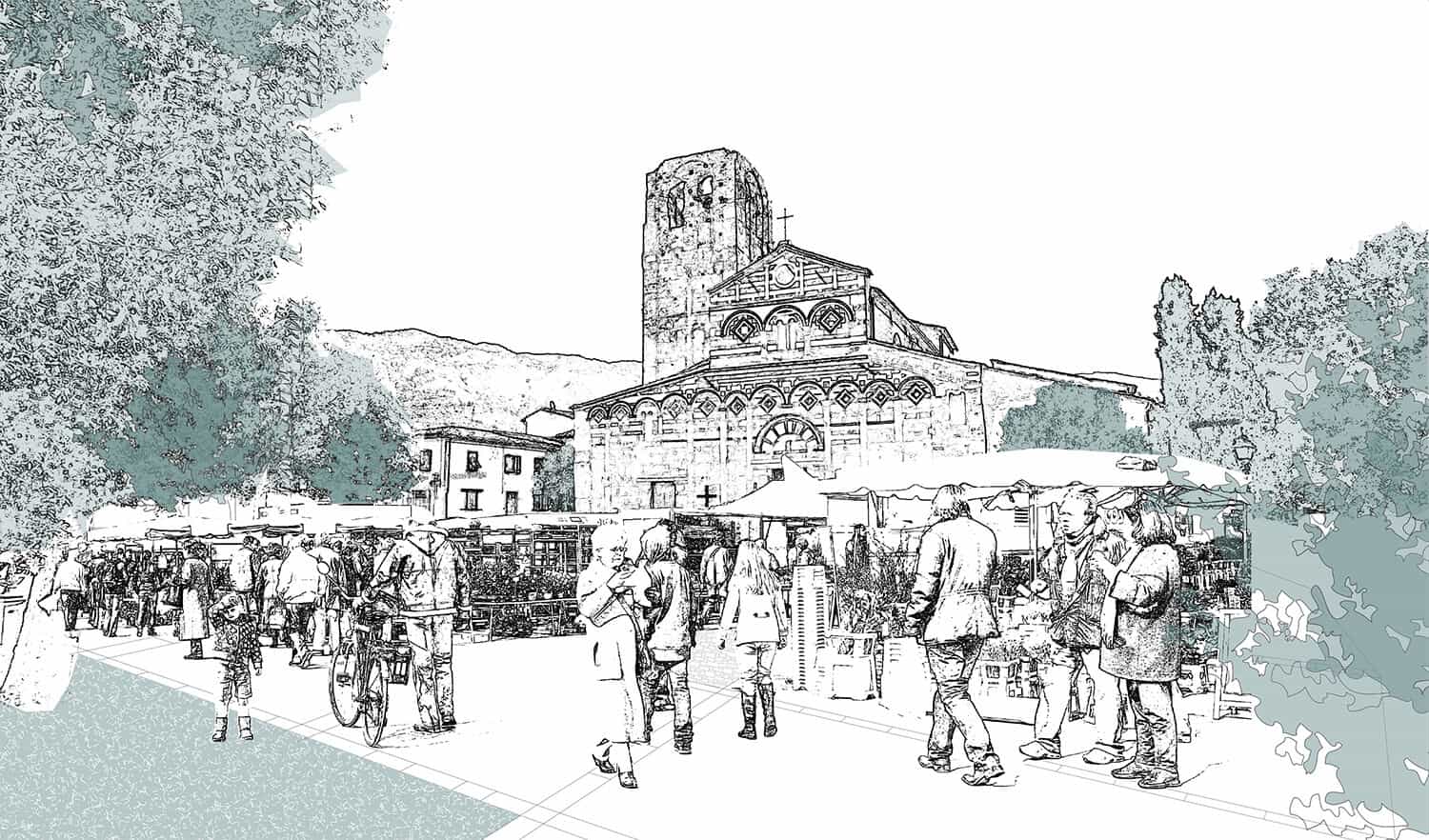
The main purpose of the project is to redevelop Via Roma, the connecting axis between the Pieve dei Santi Giovanni and Ermolao and the Certosa di Calci. These two medieval religious monuments belong to the local, provincial and national heritage. In the landscape, via Roma extends along a 40-meter contour line, which corresponds to the stretch of union between the plain of Pisa (and the Arno) with Monti Pisani, marking the entrance to the Val Graziosa and Olio street. Above this altitude the olive groves that cover Monti Pisani appear. Via Roma, therefore, performs a connecting function and offers a broad point of view on the crests and peaks of Monti Pisani. In the structure of the territory, Via Roma is a relatively recent East-West connection (end of the 19th century) and crosses a territory organized over time in an orthogonal direction - the North-South direction - that follow the topography and hydrography of the place. The development of settlements and roads has historically followed the lines of the Zambra river, whose main line descends from Castelmaggiore to La Pieve, flanked by the Provincial Road 56 (Via Oberdan Brogiotti).
The project confronts two aspects:
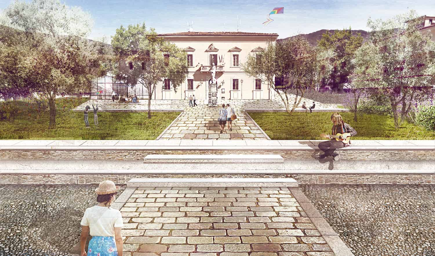
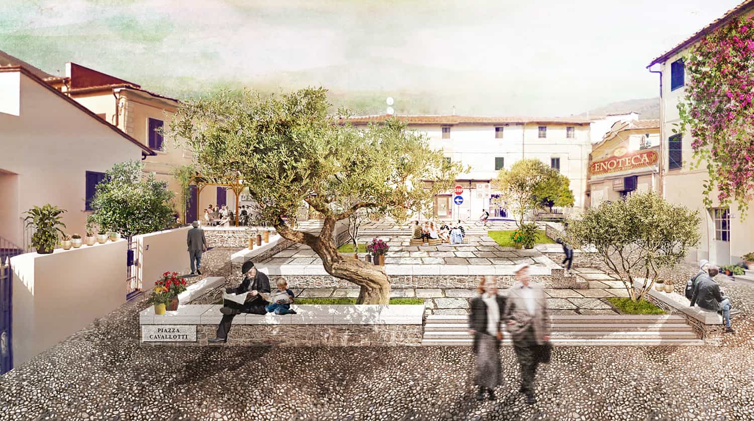
• the redevelopment of the linear East-West connection between two emblematic monuments, with Cavallotti square and the Town Hall square in an articulating role.
• work on the width of the opening in the direction to Calci’s rural landscape.
The main purpose of the project is to redevelop Via Roma, the connecting axis between the Pieve dei Santi Giovanni and Ermolao and the Certosa di Calci. These two medieval religious monuments belong to the local, provincial and national heritage. In the landscape, via Roma extends along a 40-meter contour line, which corresponds to the stretch of union between the plain of Pisa (and the Arno) with Monti Pisani, marking the entrance to the Val Graziosa and Olio street. Above this altitude the olive groves that cover Monti Pisani appear. Via Roma, therefore, performs a connecting function and offers a broad point of view on the crests and peaks of Monti Pisani. In the structure of the territory, Via Roma is a relatively recent East-West connection (end of the 19th century) and crosses a territory organized over time in an orthogonal direction - the North-South direction - that follow the topography and hydrography of the place. The development of settlements and roads has historically followed the lines of the Zambra river, whose main line descends from Castelmaggiore to La Pieve, flanked by the Provincial Road 56 (Via Oberdan Brogiotti).
The project confronts two aspects:
• the redevelopment of the linear East-West connection between two emblematic monuments, with Cavallotti square and the Town Hall square in an articulating role.
• work on the width of the opening in the direction to Calci’s rural landscape.